National Parks · Hawaii
Hawai'i Volcanoes National Park
National Park Service source material · single source. Source dates and reuse information are available beside each field.
Check the official park website for current access, conditions and visitor information.
Introduction
Background: 1
Hawai‘i Volcanoes National Park protects some of the most unique geological, biological, and cherished cultural landscapes in the world. Extending from sea level to 13,680 feet, the park encompasses the summits of two of the world's most active volcanoes - Kīlauea and Mauna Loa - and is a designated International Biosphere Reserve and UNESCO World Heritage Site.
Geography
Designation: 4
National Park
State or territory: 5
Hawaii
Park Map - Hawaii Volcanoes National Park: 6
Map scope: Hawaii Volcanoes National Park
Map of Hawaiʻi Volcanoes National Park in Hawaii. Parks, wildernesses, and reserve areas are outlined in green along the southern coastline of the Island of Hawaiʻi, and the surrounding terrain is shaded pale green and frosty gray to represent the island’s forests, deserts, and volcanic zones.
History and culture
People: 7
Between 1915 and 1917, six companies of the 25th Infantry were present in what is now Hawaiʻi Volcanoes National Park.
These Hawaiian cowboys managed livestock on the large ranches of Hawaiʻi Island, including at Kahuku
More than 100 resident Japanese were interned at Kilauea Military Camp during World War II
In the 1930s, the Civilian Conservation Corps put millions of men to work on public lands, including in Hawaiʻi Volcanoes National Park
As a Hawaiian congressional delegate, Kūhiō introduced the bill establishing what is now Hawaiʻi Volcanoes National Park
The Volcano School generation of artists brought international attention to Hawaiʻi with dramatic artistic renditions
Kenichi Maehara was the official photographer and photo concessionaire for Hawai‘i National Park.
Places: 8
For over one hundred years Hawaiʻi Volcanoes National Park has offered its visitors a window into the past through the many and varied cultural sites contained within its boundaries. Established as Hawaii National Park in 1916, the landscape of Hawaiʻi Volcanoes has been shaped by the people who have been a part of its history. Over five centuries before the establishment of the park, Native Hawaiians lived, worked and worshipped on this sacred ground. Later, in the 19th and early 20th centuries, adventurers, scientists, philanthropists, and every day individuals also left their mark on the landscape.
Cultural Landscape Inventories are a comprehensive inventory of all historically significant landscapes within the National Park System. These documents identify each landscape’s location, physical development, significance, National Register of Historic Places eligibility, condition, and other valuable information for park management. Access these formal documents below.
Moʻolelo (Stories): 9
Moʻolelo are stories, myths, legends, and part of the cultural fabric of Hawaiʻi. The word moʻolelo itself is a combination of the word moʻo , meaning a series or succession, and ʻ ō lelo , meaning words. Originally an oral tradition, moʻolelo can be entertaining, but also relay important lessons about the values, norms, and traditions of the Hawaiian people. The stories listed below are merely abbreviated summaries of important tales that have been passed from one generation to the next. Having been shared by many Hawaiians over long periods of time, different versions of moʻolelo may vary, in some cases significantly.
Collections: 10
The museum and archive collection at Hawai'i Volcanoes National Park consists of over 31,000 objects under the general classifications of archeology, ethnology, history, biology, paleontology, and geology and 1,350 linear feet of records that include documents and audio-visual material. The purpose of the museum and archive collection is to preserve the cultural, natural, and administrative activity of Hawai'i Volcanoes National Park.
Special Centennial Publications: 11
On August 1, 2016, Hawaiʻi Volcanoes National Park celebrated its centennial. In commemoration of this event, the park has produced series of publications on the history and culture of Hawaiʻi Volcanoes. The subject matter of these periodicals varies from early pre-park history and the people who forged its establishment, to philanthropic associations that have had a profound positive impact on park operations, public outreach and education. Future publications will spot light the park's museum art collection, historic preservation, archeology, and the native Hawaiian voice and perspective on Hawaiʻi Volcanoes Park amongst other topics.
The first centennial publication, "Fire on the Rim: The Creation of Hawaii National Park," (pdf - 3.4MB) , describes the tenacious actions that led to the park's establishment. It will take the reader through a brief look at the founding of the National Park, the growing Euro-American interest in Kīlauea and the few influential men behind the scenes that encouraged development of scientific study and economic tourism in Hawaii. The shrewd undertakings of men like Lorrin A. Thurston, for example, kindled the call for hotel development, and improved trails and new roadways leading to the summits of both Kīlauea and Mauna Loa. Once land easements as well as right of ways were secured from monarchal land trusts and private owners, federal appropriations needed to support the operations of Hawaiʻi National Park were released.
The second publication in our centennial series, "Gathering on the Rim: People Build a Park," (pdf-4.21MB), is a fascinating account of philanthropic relations that brought the park to fruition. It provides a brief introduction to early pre-park history of the first Euro-American visitors, Kīlauea's significant importance to scientific research, and the effect of mounting popularity and interest in the volcano. With the advent of private citizens on pleasure tours and a growing military presence, the need for visitor accommodations and improved roadways and trails were evident.
Cultural Resource Preservation: 12
The revitalization of Hawaiian traditions is an ongoing effort to honor and preserve the unique identity and legacy of the Native Hawaiian people. It is a testament to the resilience and strength of the Hawaiian community and serves as an inspiration to other cultures around the world. Learn about how the national park is preserving this culture.
The First Hawaiians: 13
Superb voyagers, Polynesians from the Marquesas Islands were the first to settle Hawaiʻi. Estimated dates of arrival vary widely, ranging from 1700 to 800 years ago. However, the most recent carbon-dating estimates place arrival and settlement in the islands between 1000 to 1200 AD. Navigating by the sun and stars, reading the winds, currents, and the flight of seabirds, Polynesians sailed across 2,400 miles of open ocean in great double-hulled canoes. They brought with them items essential to their survival: puaʻa (pigs), ʻilio (dogs), and moa (chickens); the roots of kalo (taro) and ʻuala (sweet potato); the seeds and saplings of niu (coconut), mai`a (banana), ko (sugar cane), and other edible and medicinal plants. Polynesians were well-established on the islands when Polynesians from the Society Islands arrived in Hawaiʻi. Claiming descent from the greatest gods, they became the new rulers of Hawaiʻi. After a time of voyaging back and forth between the Society Islands and the Hawaiian Archipelago, contact with southern Polynesia ceased. During the 400 years of isolation that followed, a unique Hawaiian culture developed.
Hawaiʻi was a highly stratified society with strictly maintained castes. The aliʻi (chiefs) headed the social pyramid and ruled over the land. Highly regarded and sometimes feared, the kahuna (professionals) were experts on religious ritual or specialists in canoe-building, herbal medicine, and healing. The maka`ainana (commoners) farmed and fished; built walls, houses, and fishponds; and paid taxes to the paramount chiefs and his chiefs. Kauwa, the lowest class, were outcasts or slaves.
A system of laws known as kanawai enforced the social order. Certain people, places, things, and times were sacred -- they were kapu, or forbidden. Women ate apart from men and were restricted from eating pork, coconuts, bananas, or a variety of other foods. Kapu regulated fishing, planting, and the harvesting of other resources, thus ensuring their conservation. Any breaking of kapu disturbed the stability of society; the punishment often was death.
Village life was rich and varied: Hawaiians fished in coastal waters and collected shellfish, seaweed, and salt along the shore. They raised pigs, dogs, and chickens and harvested sweet potatoes, taro, and other crops. Men pounded taro into poi (the staple food of Hawaiians), while women beat the inner bark of wauke (paper mulberry) into kapa (bark cloth). They worshipped akua (gods) and `aumakua (guardian spirits) and chronicled their history through oli (chant), mele (song) and hula (dance). Over several hundred years the people of Hawai`i cultivated traditions that were passed on through generations. But the sounds of taro pounding and kapa beating, rhythmical signatures of Hawaiian village life, would change dramatically after Captain James Cook arrived in 1778 and introduced the rest of the world to Hawai`i.
Buffalo Soldiers: 14
Two names familiar in the history of Hawaiʻi Volcanoes National Park are businessman Lorrin Thurston and geologist Thomas Jaggar. They had three goals:
To create a place to study live volcanoes (Hawaiian Volcano Observatory established in 1912)
To build a place for soldiers stationed in Hawaiʻi for rest and recreation (Kīlauea Miltary Camp established in 1916)
To develop a national park (Hawaii National Park established in 1916, formally opened in 1921)
Jaggar, new head of the observatory, described Mauna Loa , the large, rounded shield volcano that makes up more than half of Hawaiʻi Island as, “... a vast desert waste without water and rising to an immense height. Every expedition to the summit exhausts the energies of the men and animals employed and the animals are frequently crippled and have their legs cut through by the rough black lava. Consequently the ranchers will not rent good animals at any price and as there is no shelter on the summit, little water, no feed, violent winds and low temperatures, the men who can with difficulty be induced to go and act as guides or packers object to remaining overnight.” He wanted an easier route than the traditional one through ʻĀinapō for geologists to access the 13,681-foot summit of Mauna Loa. Thurston was promoting the idea of a national park at Kīlauea and saw a trail to the Mauna Loa summit as an opportunity for expanded tourism. The idea for the Mauna Loa Trail was born. Under the headline, “Soldiers Building Mountain Trail,” the Maui News reported, “Negro soldiers of the Twenty-fifth Infantry to the number of 150 are at work constructing a trail from near the Volcano House to the summit of Mauna Loa. It is estimated that three or four weeks will be devoted to this work. The soldiers are doing the work as a part of their vacation exercises .” (Emphasis added.)
Aliʻi: 15
Centuries after the first Polynesian voyagers settled in Hawaiʻi , a new wave of Polynesians arrived. Known as the Kānaka Maoli, meaning “the people”, they brought along different ideas and concepts from their culture. The isolated feudalism that had existed previously in the islands was forced to change. A new and distinct culture began to take shape based on a caste system and a religious structure that provided a strong connection between the people and the land. People were born into specific social classes without the ability to move into another, except in the case of falling into outcast status. Each class within the caste system had assigned duties and responsibilities to the greater society. The classes, in order of social status, were:
Japanese Detention at Hawaiʻi Volcanoes: 16
More than 100 resident Japanese were interned at Kilauea Military Camp in World War II Less than 4 hours after the Japanese attack on Pearl Harbor on December 7th, 1941, territorial governor Joseph B. Poindexter invoked the Hawaii Defense Act giving him absolute wartime power in Hawai‘i. By mid-afternoon (3:30pm) the decision to place the territory under martial law was made, suspending the writ of habeas corpus and placing control of Hawaiʻi under Lieutenant General Walter C. Short, who became Military Governor. Kilauea Military Camp within Hawaiʻi Volcanoes National Park (then known as Hawaii National Park), had been a quiet military recreation facility. By the end of the day on December 7th, it became a detainment camp, eventually holding more than 100 resident Japanese. These detainees were just a few of what amounted to about 2,000 persons, 1/3 of which were American citizens, incarcerated from Hawaiʻi.
With the advent of war, staff at Hawaii National Park sprung into action to defend the park and support the military. With a ready infrastructure available, Major General Ralph Pennel (who assumed command of the District of Hawaii), set up a headquarters and command post in the park, and KMC became a center of activity. In 1941, it became an important staging ground for the war. From March to October 1942, KMC became the headquarters for the Twenty-seventh Division of the Army. While the attack on Pearl Harbor was a surprise and shock, the government had been preparing to deal with possible subversion within its borders. Prior to the outbreak of war, the FBI had developed a Custodial Detention List (CDL) of citizens, enemy aliens and foreign nationals that included many Japanese and Japanese-Americans residing in Hawai‘i. Information was gathered and analyzed in the heightened interest of national security as Japanese and German military aggression increased. The Alien Registration Act of 1940 required the registration and fingerprinting of all aliens above the age of 14 living in, or entering, the United States. Under this federal act, approximately 6,000 aliens in Hilo and others in outlying portions of the island were registered and fingerprinted. By early 1940, the offices of Military and Naval Intelligence had a list of names and addresses of Issei (first generation immigrants) and Nisei (second generation) who were considered dangerous and would be picked up for detention at the outbreak of war, and a list of individuals who were considered less dangerous but would be put under surveillance during war.
The Federal government decided that in Hawai‘i the alien population would be controlled by the War Department. Since there were over 41,000 Japanese aliens, and over 115,000 Japanese citizens in the state of Hawai‘i, the War Department concluded it was impossible to place one tenth of the population of Hawai‘i in concentration camps. A December 4, 1941 memo from Special Agent R.L. Shivers to the Director of the FBI stated that there were 338 Japanese aliens and nine Japanese American citizens in Hawai‘i to be seized immediately. Of those, 82 were from the island of Hawai‘i. More were picked up, however, as the war went on and fear of sabotage continued. Against the desires of President Roosevelt, Assistant Secretary of War Mr. Bundy informed the FBI on December 22, 1941 that they were not going to relocate and intern all of the Japanese in the islands. Roosevelt was particularly concerned about the Japanese living on O‘ahu and Hawai‘i island, and suggested they at least be removed to one of the other islands in the Territory. But the War Department decided they would be selective in who they detained. Thus, they focused on businessmen, consular agents, Japanese language school teachers and principals, Buddhist and Shinto priests, and those who had Japanese military service, or who were deemed to have “extreme nationalistic sentiments” and were therefore considered a danger to American security. On the day Pearl Harbor was attacked, the War Department ordered that everyone on the CDL be arrested. The FBI and Army Intelligence immediately began to pick up those who had been identified. Altogether, two-thousand Japanese, Germans, and Italians were detained or interned at seventeen locations throughout the islands.
Many Hawai‘i Island detainees were taken to KMC, which was transformed overnight from an R&R facility to a prison. The first detainees arrived at KMC in the afternoon of December 7, 1941. While at KMC, detainees were confined to their barracks and were marched to the adjacent mess hall for meals. At approximately ten o’clock every day, for one hour, the detainees were allowed outside for exercise. While at KMC, they were surrounded by guards on foot, and on top of a guard tower. New detainees were brought in continuously. The FBI would come up to question those who were detained, and many were driven down to the federal building in Hilo for their board hearing. The detainees did not stay at KMC long, because under international law interned aliens could not be held in a combat zone and had to be taken to where hostilities were unlikely. The first group of 106 detainees transferred from KMC to O‘ahu on February 20, 1942. The last group of 25 was transferred on May 7, 1942.
Prince Jonah Kūhiō Kalanianaʻole: 17
He was a royal prince, a revolutionary, and a Hawaiian Delegate to the United States House of Representatives for 10 terms. Prince Jonah Kūhiō Kalanianaʻole Piʻikoi, known primarily as “Kūhiō” (or by his childhood nickname “Prince Cupid”) is the only member of Congress ever born into royalty. Kūhiō was born on March 26, 1871. When King David Kalākaua assumed the throne of the Hawaiian Kingdom, it was the start of a new dynasty in the islands and Kūhiō and his two older brothers were declared royal princes. In January, 1893 the Hawaiian monarchy was overthrown by American businessmen. In the last weeks of 1894, Kūhiō joined other native Hawaiians in an attempt to restore the monarchy. They were unsuccessful, and Kūhiō was among those arrested for treason. He served a year in prison. Upon his release, he left Hawaii and vowed never to return to a Hawaiʻi that appeared inhospitable to Hawaiians. Kūhiō eventually returned from this self-imposed exile to take part in politics in post-annexation Hawaiʻi. Kūhiō was often called Ke Ali‘i Maka‘āinana (Prince of the People) and is well known for his efforts to preserve and strengthen the Hawaiian people. Among his many accomplishments in Congress for the Kanaka Maoli are:
As a Hawaiian congressional delegate, Prince Kūhiō introduced the Hawaiʻi National Park bill in 1916, which sought to establish a Hawaiʻi National Park covering land on Kīlauea, Mauna Loa, and Haleakalā. Thomas Jaggar, director of Hawaiian Volcano Observatory, testified in support of the bill and President Woodrow Wilson signed the bill into law. Funding for the the new park however was not immediate (as one Oregon congressman complained, "It should not cost anything to run a volcano"). What was founded as Hawaiʻi National Park was later divided into Hawaiʻi Volcanoes and Haleakalā National Parks, and both continue to enjoy the federal funding that Kūhiō fought for. Prince Kūhiō died in 1922, the last Prince of Hawaiʻi.
Mark Twain at Kīlauea: 18
In 1866, fifty years before what is now Hawaiʻi Volcanoes National Park was established, author and humorist Mark Twain ventured to the then-erupting summit of Kīlauea. Part of a four month visit to the islands as a correspondent for the Daily Union newspaper of Sacramento, he traveled to Oʻahu, Maui, and the island of Hawaiʻi. His dispatches were published serially in the newspaper throughout that year and later compiled in a volume entitled "Letters From Hawaii". On the island of Hawaiʻi, Twain spent time at Kealakekua Bay, the "city of refuge" ( Puʻuhonua o Hōnaunau ), and the small settlement of Waiohinu, but wrote perhaps most romantically about "a scene of wild beauty" at the fiery Kīlauea. After a long and rough horseback trek up to the summit from Kaʻū, Twain initially expressed disappointment at the sight of the massive caldera. "A wide, level, black plain," he remarked that it seemed to be "a large cellar - nothing more". Only after a deeper look at the scenery did a sense of scale descend upon him. "The reason the walls looked so low is because the basin inclosed is so large. The place looked a little larger and a little deeper every five minutes, by the watch." Soon, he notes, "About this time I saw an object which helped to increase the size of the crater. It was a house perched on the extreme edge of the wall, at the far end of the basin, two miles and a half away; it looked like a martin box under the eaves of a cathedral!" While at Kīlauea, Twain stayed at Volcano House , which was situated in a different location on the rim than it is today. He described the hotel in glowing terms, saying it was, "neat, roomy, well furnished and well kept." "The surprise of finding a good hotel in such an outlandish spot startled me considerably more than the volcano did."
That night, he ventured to an observation point overlooking the caldera, which at that time was in the middle of a prolonged period of eruption. The summit of Kīlauea consistently featured a lava lake during the period from 1790 to 1924. "The greater part of the vast floor of the desert under us was as black as ink, and apparently smooth and level; but over a mile square of it was ringed and streaked and striped with a thousand branching streams of liquid and gorgeously brilliant fire! It looked like a colossal railroad map of the State of Massachusetts done in chain lightning on a midnight sky" "...the fiercest jagged lightning. These streams met other streams, and they mingled with and crossed and recrossed each other in every conceivable direction, like skate tracks on a popular skating ground. Sometimes streams twenty or thirty feet wide flowed from the holes to some distance without dividing - and through the opera-glasses we could see that they ran down small, steep hills and were genuine cataracts of fire, white at their source but soon cooling and turning to the richest red, grained with alternate lines of black and gold."
The lava lake engaged Twain's other senses as well. "The noise made by the bubbling lava is not great, heard as we heard it from our lofty perch. It makes three distinct sounds - a rushing, a hissing, and a coughing or puffing sound; and if you stand on the brink and close your eyes it is no trick at all to imagine that you are sweeping down a river on a large low pressure steamer, and that you hear the hissing of the steam about her boilers, the puffing from her escape pipes and the churning rush of the water abaft her wheels. The smell of sulfur is strong, but not unpleasant to a sinner." After returning to the Volcano House, he gazed back at the large cloud gathered above the crater. "I thought it just possible that its like had not been seen since the children of Israel wandered on their long march through the desert," "And I was sure that I now had a vivid conception of what the majestic "pillar of fire" was like, which almost amounted to a revelation."
Lieutenant Charles Wilkes: 19
The US Exploring Expedition, led by Lt. Charles Wilkes, was the first US exploring and surveying expedition to the South Seas. Six ships carried 346 naval personnel and scientists, who were charged with the task of providing detailed maps of the region for the American shipping industry. The expedition was at sea from 1838 to 1842 in the around-the-world voyage.
Between December 1840 and January 1841, Wilkes took a contingent of scientists to the summit of Mauna Loa. From Kīlauea Crater, the expedition took five days to reach the summit. Once there, a camp was set up with rock walls to buttress tents against the extreme weather conditions, and the expedition could carry out observations and mapping. The expedition mapped the summit region and conducted scientific efforts in the relatively unknown alpine wilderness area. The expedition team was supported by nearly 300 natives who served as porters on the arduous climb to the summit. The contingent broke camp on January 13 and returned to Kīlauea leaving the remains of their camp site behind.
Today, all that is left are the walls of Wilkes' camp. The site is on the National Register of Historic Places - a lasting legacy to the incredible voyage of discovery. Read about Wilkes, other early explorers of Mauna Loa, and this incredible site in " Giant of the Pacific ," (pdf - 9.87MB), an archeological report by Dennis Dougherty.
George W. C. Jones: 20
In his 72 years, George Jones was a “forty-niner,” a sailor, an entrepreneur, an innkeeper, a rancher, and a father to 12 children! Born in New York City in 1831, he left home at age 18, one of the California gold rush “forty-niners.” After amassing an amount of wealth in those endeavors, he “shipped before the mast” (meaning he sailed as a common seaman) in 1855 to Honolulu. There he met his future wife Harriet Neddles Gilman, who was the daughter of a high Chiefess (Harriet Kapu Kawahaea). The couple went to live at Keauhou Landing in Kaʻū, about 15 miles south of Kīlauea. At Keauhou Landing he went into the pulu business (referring to the soft fiber from the hapuʻu fern used as stuffing for pillows and mattresses ) with an American named King and Judge George Anson Byron Kaina of Hilo. Meanwhile, noticing that there were no accommodations for visitors to the “lake of fire” at Kīlauea, he saw an opportunity, and in 1866 with Charles and Jules Richardson built the first Volcano House of koa and ʻōhiʻa wood with a thatched roof of pili grass. None other than Mark Twain wrote, “The surprise of finding a good hotel in such an outlandish place startled me more than the volcano did!”, during his visit to Kīlauea . In 1877, Jones bought out his partnersʻ interests and became the sole owner of the hotel. In 1871, Jones, with the Richardsons and Kaina, bought the Kahuku Ranch , at that time encompassing the entire the ahupuaʻa of Kahuku (184,298 acres). The hospitality of Kahuku Ranch during Jonesʻ tenure was well known and always extended to visitors, whether friends or total strangers. Some of the more well-known visitors were Charles R. Bishop, Sanford Dole, Prince Leleiohoku (King Kalākauaʻs brother), Princess Kaʻiulani and her mother Princess Likelike. The Mauna Loa eruption of 1887 created a flood of sight-seers to the ranch, and two weeks after the eruption they were still coming. In a letter to his son-in-law Jones wrote, “The place is overrun with crowds. Every place filled and even the native places crowded with haoles. Have had 20 strangers here to provide for all the time – one party leaving and the other arriving... There is no place free from the intrusion of the crowds... The privy, my wifeʻs room and even my office would be occupied as soon there was a door open." His obituary in the Honolulu Advertiser on November 25th, 1903, noted, "When the great lava flow of 1887 crossed his premises at Kahuku, Mr. Jones put on record intelligent data of the eruption and attendant earthquakes, sending some of them promptly to the Honolulu press.”
Kenichi Maehara and the Volcano Photo Studio: 21
Kenichi Maehara was the official photographer and photo concessionaire for Hawai‘i Volcanoes National Park (then called Hawaii National Park) from 1930 to 1941. He immigrated to Hawai‘i from Hiroshima, Japan in 1896 1 and grew to become a renowned and respected local businessman whose photos of volcanic eruptions were published and distributed around the world. 2
Maehara’s Volcano Photo Studio was his second studio on the Island of Hawaiʻi after his Camera Craft Shop in Hilo. The building was constructed with the approval of the National Park Service in 1930 and was unique for its Japanese style and design. 3 The park studio offered visitors “everything photographic,” 4 including colorized postcards and pictures of past volcanic eruptions for purchase. If it still stood today, the Volcano Photo Studio would be located near the current Kīlauea Visitor Center.
A few months after the Japanese military attack on Pearl Harbor on December 7, 1941, Kenichi Maehara was arrested and detained under suspicion of disloyalty to the United States. Evidence used against him included photos he had taken of the 1935 U.S. military bombing of a Mauna Loa lava flow. Ironically, these photos were commissioned by the U.S. government; Maehara sent one of his employees to capture the photos after receiving a request from Dr. Thomas Jaggar, director of the Hawaiian Volcano Observatory.
Kenichi Maehara was declared a security threat because of these photos of “a military classified matter” and for his participation and leadership in the local Japanese Association. 5 He was sent to an internment camp in the state of New Mexico in May 1942. The Volcano Photo Studio was demolished by the national park while Maehara was interned. His wife supported the family during this time by colorizing and selling her husband’s black and white photos, including those he took of past volcanic eruptions. Kenichi Maehara remained interned until November 7, 1946. 6 After his release, he reunited with his wife on Oʻahu. He would never return to the national park in an official capacity. The retired couple moved to Japan in 1960 where Maehara died a few years later. 7
Kenichi Maehara; Sheet 3B, line 26, Enumeration District 117, South Hilo, Hawaii, Hawaii Territory; Fourteenth Census of the United States, 1920 (National Archives Microfilm Publication T625 roll 2033); Records of the Bureau of the Census, Record Group 29.
Volcano Photo Studio Co., Ltd. “Congratulations to George and Nick Lycurgus,” advertisement. Hilo Tribune Herald. Nov. 8, 1941.
Hawaii, Civilian Internees: Maehara, Kenichi, alias Kenzo Maehara; 900756; Subject Files, 1942-1946; Records of the Office of the Provost Marshal General, 1920-1975, Record Group 389; National Archives at College Park, College Park, MD.
Japanese Internee Card for Kenichi Maehara; 1092499; World War II Japanese Internee Cards, 1941-1947; General Records of the Department of Justice, 1790-2002, Record Group 60; National Archives at College Park, College Park, MD.
Pahu Manamana o ʻUmi: 22
High on the southwest slopes of Mauna Loa is a significant archaeological site containing a low, dry-stacked pahoehoe platform (paepae) with several upright stones atop it (manamana) and a small stack of rocks in front of the platform (pānānā). This feature has come to be known as Pahu Manamana o ‘Umi.
Using historical chants and traditional ecological knowledge passed down through generations, the Edith Kanakaʻole Foundation (EKF) conducted extensive anthropological and astronomical research on the origin and function of this feature. They associated the site with ʻUmi or ʻUmialīloa, an aliʻi nui (high chief) who ruled the Island of Hawaiʻi around the early 16th century. ‘Umialīloa is credited with creating many similar solar and stellar instruments known as pahu manamana.
The researchers utilized a traditional Papakū Makawalu methodology to analyze the structure. Papakū Makawalu divides the universe into three interconnected regions: Papahulilani which relates to the activities of the heavens, Papahulihonua which concerns the elements of the earth, and Papahānaumoku which incorporates the cycles of all living things. Using this method, the researchers theorized that this site once functioned as a stellar instrument with points on the uprights corresponding to the locations of specific stars in the night sky. They also theorized that it functioned as a geographic compass with each upright stone correlating with locations in Hawaiʻi and Polynesia. The researchers concluded that Native Hawaiians may have utilized instruments like this one to track the moving planets, the rising and setting of stars, and the creation of the pae ʻāina (the archipelago of Hawaiʻi) as islands move over the volcanic hotspot.
EKF completed the study of Pahu Manamana o ʻUmi in 2018 and utilized their observations a year later on a research voyage to the small, culturally and spiritually significant Northwestern Hawaiian Island of Mokumanamana. The forty-six acre island hosts a dense concentration of pahu manamana similar in construction to the one found on Mauna Loa. In collaboration with Native Hawaiian navigators, part of the research team sailed on a traditional voyaging canoe using a star alignment between Pahu Manamana o ‘Umi and Mokumanamana observed during the 2018 study. Navigating solely with traditional methods, they successfully reached their destination. This practical implementation of the study’s findings supports the theory that pahu manamana could be used as navigational tools ( link to news video of the voyage ).
EKF’s continued research on pahu manamana furthers our understanding of how these historical instruments may have been used in Hawaiian navigational astronomy and how similar sites across the archipelago may be related. The research also helps us better understand connections Native Hawaiians recognized in the environment and how those connections may have influenced aspects of Hawaiian life, including the keeping of time, religious ceremonies, and political governance. Read the report to learn more about this facinating research.
Archeology of the “Mystery Islands” Nihoa and Mokumanamana (U.S. National Park Service) (nps.gov)
The Great Crack and Ala Waiʻi: 23
Hawai‘i Volcanoes National Park includes two parcels of land known as the Great Crack and Ala Waiʻi parcels. These parcels are situated in a remote region that encompasses the lower end of the Southwest Rift Zone of Kīlauea volcano. The park successfully acquired the first 1,951-acre parcel in 2018 and the second 2,750-acre parcel in 2022. These areas represent exceptional examples of the region's geologic dynamism, featuring a landscape dominated by barren lava rock with scarce surface water, limited tree growth, and little shade.
Located in the southwest rift zone of Kīlauea volcano, the Great Crack is an extensive network of cracks, fissures, and cones. It spans an impressive 18 miles (28 kilometers) in length, measures 50 feet (15 meters) in width, and plunges down to a depth of 66 feet (22 meters). Hawaiian Volcano Observatory (HVO) geologists believe that the crack formed as magma intruded into the rift zone causing the surface to spread. While the exact time of its formation remains uncertain, research indicates that it might have occurred gradually over time.
In 1823, an eruption caused lava to surge out from the lower section of the Great Crack and flow for about 6 miles (10 kilometers) into the ocean, destroying one small coastal village at Mahuka Bay. English Reverend William Ellis (1794-1872) and his company witnessed the aftermath of the eruption. A hundred years later, geologist Harold Stearns officially named it the "Keaiwa Flow," which was a name the residents of Ka‘ū had been using informally back then.
The eruption was noteworthy because the extremely fluid lava moved rapidly and reached the ocean. As the lava flowed, it left a smooth coating on older structures, now referred to as the "Lava Plastered Cones."
Interestingly, even when historically large earthquakes occurred, the Great Crack did not increase in size. The delicate 1823 lava flow remains intact, and did not show any signs of growth following the 7.9-magnitude earthquake of 1868, the largest documented earthquake in Hawaiʻi. Similarly, measurements taken during the 7.2-magnitude south flank earthquake in 1975 also revealed no changes in the area of the Great Crack.
Kahuku-Pōhue: 24
Located on the southern flank of Mauna Loa, the Kahuku-Pōhue parcel is home to numerous well-preserved and significant Hawaiian cultural sites, including the largest recorded abrader quarry in Hawaiʻi, lava tubes, mauka-makai (mountain to sea) trails, fishing shrines, remains of once-thriving coastal villages, and petroglyphs. A well-preserved portion of the Ala Kahakai National Historic Trail or Ala Loa, an ancient coastal trail system, hugs the coastline.The Pōhue coastline is also critical habitat for federally listed endangered Hawaiian species, including honu‘ea (Hawaiian hawksbill turtle) and ʻīlioholoikauaua (Hawaiian monk seal). Rare endemic ʻōpaeʻula (red shrimp) live in the area’s anchialine ponds, and the bay is often frequented by native and migratory birds, including ʻiwa (frigate bird), koaʻe kea (white tailed tropic bird), kōlea (golden plover), ʻūlili (wandering tattler) and ʻaukuʻu (black crowned night heron).
On July 12, 2022, the Trust for Public Land (TPL) transferred ownership and stewardship of Kahuku-Pōhue to the National Park Service. The 16,451-acre parcel—from Māmalahoa Highway to the shoreline—is now part of Hawaiʻi Volcanoes National Park. Trust for Public Land has also donated $800,000 to the Friends of Volcanoes National Park to support the National Park Service’s management of Pōhue Bay.
Before the land transfer, NPS took proactive steps and met with community members in partnership with TPL and the Hawaiʻi Alliance for Community-Based Economic Development (HACBED) to better understand the land's cultural, historical and ecological significance. The park is calling the new section the “Kahuku-Pōhue parcel” in reference to the Hawaiian place name, Kahuku. Kahuku is the mauka-to-makai (inland to ocean) ʻahupuaʻa (historic land division), in which Pōhue is located. In addition, many Kaʻū locals refer to the bay as Pōhue Bay and its adjacent beach as Kahuku Beach. The park welcomes additional information about other ʻinoa ʻāina (Native Hawaiian or indigenous) place names for Kahuku-Pōhue.
Public access is temporarily restricted until interim operating procedures are complete, and safe access that protects the precious resources can be provided. There are no bathroom facilities, no formalized parking or capacity for trash removal and emergency response is very limited. Existing roads and trails pass through private property before reaching the shoreline, and the park does not have the authority to allow access through private property.
The park will release a Comprehensive Site Management Plan and Environmental Assessment on June 2, 2026. Part of the plan includes implementing a pilot permit system that will allow day-use pedestrian access to the Kahuku-Pōhue shoreline and improves visitor access and services for the Kahuku Unit. Community feedback helped shape the site management plan. It is anticipated that after the planning process is complete, the park will implement a pilot permit system for day use. Please e-mail us for feedback or questions. The public map of the Kahuku-Pōhue parcel provides information on land ownership, geological features, inoa ʻāina (Native Hawaiian place names), and more.
Kaʻauea: 25
Although this hale is new, it is only the latest structure in the area. Two other hale were previously built in this spot, in 1981 and 2009. The hale and kahua hula help share kahiko hula and are places where visitors can learn about the traditional Hawaiian culture connected to Hawai‘i Volcanoes National Park.
Pu‘uloa Petroglyphs: 26
Puʻuloa, translated as the "long hill" or "Hill-(of)-long-(life)" from Hawaiian, is a place considered sacred to the people of Hawai`i, and those of Kalapana in particular.
Located in the ahupuaʻa (an ancient Hawaiian land division) of Pānau Nui on the southern flank of Kīlauea volcano, Puʻuloa is the name of the site which contains a vast area covered with incredible numbers of pecked images in the harden lava, images known as petroglyphs. The archaeological site of Puʻuloa contains over 23,000 petroglyph images; motifs containing cupules or holes (84% of the total), motifs of circles, other geometric as well as cryptic designs, human representations known as anthropomorphs, canoe sails, and even feathered cape motifs.
In geologic terms, the center of Puʻuloa consists of a volcanic pressure dome with outlying areas of ancient, relatively level fields of pāhoehoe lava bedrock (pāhoehoe, being one of the two types of lava found in Hawai`i, a rather smooth surfaced substrate), dated geologically between AD 1200-1450.
Reverend William Ellis, a missionary to the Hawaiian and Society Islands, recorded the earliest written observation of the petroglyphs at Puʻuloa in 1823:
Along the southern coast, both on the east and west sides, we frequently saw a number of straight lines, semicircles, or concentric rings, with some rude imitations of the human figure, cut or carved in the compact rocks of lava. They did not appear to have been cut with an iron instrument, but with a stone hatchet, or a stone less frangible than the rock on which they were portrayed.
On inquiry, we found that they had been made by former travelers, from a motive similar to that which induces a person to carve his initials on a stone or tree, or a traveler to record his name in an album, to inform his successors that he had been there.
When there were a number of concentric circles with a dot or mark in the center, the dot signified a man, and the number of rings denoted the number in the party who had circumambulated the island. When there was a ring and a number of marks, it denoted the same; the number of marks showing of how many the party consisted; and the ring, that they had traveled completely around the island; but when there was only a semicircle, it denoted that they had returned after reaching the place where it was made. [1917:203]
Almost one hundred years later, in 1914, noted anthropologist Martha Beckwith visited Puʻuloa and made this observation:
July 1, 1914. Rode out to Puuloa on the line between Kealakomo and Apuki. Here is a large pahoehoe mound used as a depository for the umbilical cord at the birth of a child. A hole is made in the hard crust, the cord is put in and as stone is placed over it. In the morning the cord has disappeared; there is no trace of it. This insures long life for the child. Mrs. Kama, born in 1862, was a native of Kamoamoa. Her mother brought her cord there. She had 15 children and for each one at birth the visit was made to Puuloa. Another mound, on the southern boundary of Apukiu., called Puumanawalea, was similarly used….Puuloa is especially rich. There are holes, pictures, initials chiseled into the rock.
A dot was " the hole for a child" A dot in a circle "the hole for the first born" A dot with two circles "the first born of an ali`i [a ruling chief]" A plain circle was a "calabash" A jagged line was a "mo`o [a lizard]" A circle with a long line was a "puloulou [ a tapa covered ball on a stick carried by an ali`i as a symbol of taboo]" A cross with a dot at each end was " a cross before a chief at night in travelling."
Thus, the interpretation of Hawaiian petroglyphs is not a solely aesthetic one. Though some very beautiful in their presentation, petroglyphs also serve a deeper purpose. Petroglyphs at Puʻuloa are interpreted to have recorded travel around the island of Hawaiʻi, express consideration for human longevity and well being, communicate events current and past, as well as mark boundaries and trails.
In the past, taking a rubbing of a petroglyph image or chalking the outline was a practice some would undertake to create a copy or duplicate or to enhance a photographic image of a petroglyph. Today, we know that any abrasion, scuff, or rubbing to the petroglyph image damages the feature by exacerbating the erosion process, which brings about the eventual destruction of the resource. Advancement in the archaeological recordation process by utilizing photographic documentation, precise measurements, skilled illustrators, as well as the accumulation of data on petroglyphs allowing us to better understand the process by which petroglyphs are created, and the oral history to better understand the meaning behind the motifs, all aid in the advancement and protection of this important petroglyph site.
One of the ways early park administration considered to protect the petroglyphs at Puʻuloa was to construct a boardwalk above the ground surface, elevating a pathway upon which visitors could walk and view a section of the extensive area and variety of petroglyphs at the site.
Puʻuloa is made accessible with a parking area pullout and an emergency call box along Chain of Craters Road at Milepost 16.5. From the pullout parking area it is a 0.7-mile walk over a gently undulating pahoehoe lava bedrock trail to reach the boardwalk at Puʻuloa.
Puʻuloa is not the only place within Hawai`i Volcanoes National Park that one sees petroglyphs created on the lava substrate. Single petroglyph images, petroglyph panels, and petroglyphs created in a linear or other pattern can be seen in many locations at the coast as well as along the slopes of Kīlauea volcano, each serving its own purpose. Take a day hike to Puʻuloa Petroglyphs
Keonehelelei - The Story of the Footprints Area: 27
Keonehelelei - The Story of the Footprints Area Footprints Archeological Site Brochure - (pdf 3.3MB) (Note: The complete report is available in pdf format (6.73MB) Keonehelelei )
In 1857 a 19 year old tax assessor named Frederick S. Lyman was travelling around Hawaiʻi Island. As part of the tax assessment process, Lyman had to estimate the age of individuals being taxed. Most Hawaiians did not know their ages but could associate their births, in relative terms, with famous "occurrences." Thus, as he carried out his assessment, Lyman recorded the information given to him by Native informants and compiled a List of Dates of these famous events. This list served as a means of consistently estimating the ages of individuals. In this list five events were recorded to have occurred in the year 1790. Amongst these events is one buried within the list called Keonehelelei , "the falling sands."
Footprints fossilized in the Kaʻu Desert ash. Fast forward to the year 1919, when Ruy H. Finch, a geologist at the Hawaiian Volcano Observatory discovered human footprints fossilized in the Kaʻu desert ash. The discovery of the prints was purely accidental. In 1919 lava from Halemaʻumaʻu drained out of the crater and erupted in an area of the Kaʻu Desert. The eruption built a hill called Mauna Iki. Although the eruption area was only three miles from the then Hilo-Kona road, to get to Mauna Iki Finch and his crew had to walk nearly twelve-miles through the desert. A shorter route was available, but if the crew chose to access this route they had to walk over the very rough Keamoku ʻaʻa flow. While walking through this shorter route Finch and his crew discovered human footprints preserved in the hardened desert ash. After they were discovered, a crude trail was marked through the jagged Keamoku flow, and many people visited the area. Soon, this area of the desert which, in 1919, was not part of the newly formed Hawaiʻi National Park, became known as "Footprints" or the "Footprints area."
Acquisition of the Footprints area became a goal of the Park Service after a visit to Hawaiʻi National Park by National Park Director Stephen Mather in 1919 and later by his assistant Horace Albright in 1920. Both Mather and Albright recommended that the Footprints area be included as part of Hawaiʻi National Park. The area shared a common border with the Park and would extend the boundaries of the Park to the seacoast on the southwest side. The Park Service had to convince the Territory of Hawaii to give up its rights in this portion of Kapapala. Originally, the entire ahupuaʻa of Kapapala was the personal property of Hawai`iʻs monarchy. After the overthrow of the Hawaiian monarchy in 1893, the lands belonging to the Crown were ceded to the newly formed Hawaiian Government. Because the Footprints section was now government land the Park had to enter into negotiations with the Territory of Hawaiʻi to acquire it. Congress approved the acquisition request and the Footprints bill was signed into law on June 20, 1938, twenty-one years after the fossilized prints were first identified.
In the years following the Park's acquisition of the Footprints piece, the area remains relatively unchanged. Park trails were added and in 1941, the Civilian Conservation Corps constructed a shelter in the desert specifically for the interpretation of the footprints. Nearly 63 years after acquiring this piece hundreds of visitors have experienced the Footprints area and it has been given national recognition.
In 1974, a rectangular shaped parcel covering approximately 4,284 acres within the Footprints area was nominated to the National Register of Historic Places. The area was nominated to the register because the prints were recognized as unusual features found nowhere else in Hawaiʻi, and the story behind the creation of the prints associated this area with a unique event in Hawaiian history.
At the time it was nominated to the National Register, the Footprints area was already a popular spot for visitors. Interpretive efforts by the Park Service as well as popular books and magazines have helped spread the story behind the creation of the footprints beyond the first written account found in the 1823 journal of William Ellis.
In 1782, Kalaniopuʻu, Aliʻi Nui of Hawaiʻi, died. In accordance with his wishes, his son, Kiwalaʻo became heir of Hawaiʻi Island. Kamehameha, the nephew of Kalaniopuʻu, had hoped to be named his successor. When he was not, Kamehameha became upset and launched a campaign to overthrow his cousin Kiwalaʻo. In July 1782, Kamehameha defeated Kiwalaʻo at the Battle of Mokuohai. Unbeknownst to Kamehameha, some of Kiwalaʻo's family members escaped the battle. Keoua, Kiwalaʻo's half-brother, was one of the warriors who survived. Keoua returned to his home district of Kaʻu. Keoua's uncle, Keawemauhili, was able to escape as well and he returned to his home district of Hilo.
For some time, these three leaders kept to themselves not wanting to accept one or the other as paramount chief. Keawemauhili finally decided that he was going to accept Kamehameha as his aliʻi nui and sent his own sons to assist Kamehameha in his efforts to gain control of the islands. This decision enraged Keoua. He decided to take action and thus attacked Hilo, killing his uncle. The death of Keawemauhili, however, was not enough. Keoua drove Kamehameha's army to Hamakua ravaging the lands in his wake.
Kamehameha quickly counterattacked and drove Keoua back to Hilo. The battle in Hilo not being decisive, both armies retreated, with Keoua heading back to his home district of Kaʻu. The route to Kaʻu that Keoua and his troops chose was by way of Kīlauea Volcano. Keoua and his army started their march to Kaʻu and on the first night camped on Kīlauea near a heiau dedicated to Pele, the fire goddess. This was a period of volcanic activity at Kīlauea caldera. Fearing they had somehow angered Pele, Keoua decided to remain there for several days to bestow offerings in an attempt to appease her. Upon leaving Kīlauea summit, Keoua split his army into three different companies that left the crater at different intervals.
The first company had not gone far when the earth started to tremble violently. Volcanic ash and hot gas exploded out of the caldera. Then, a huge, dense cloud of ash, sand and rocks was ejected out of the crater and rained down for miles around. Unable to escape, all of the individuals in the second party died. One lone pig is said to have survived.
Not far behind, the rear-company by chance survived the catastrophe because they were not in the path of the hot ash. Picking themselves up, they continued on their journey determined to get to Kaʻu. They were startled when they came upon members of the second company lying down across the desert floor. When to their surprise, the second company was not resting but in fact lay dead. Discovering this, it is believed that the rear-company choose to move on, not staying to mourn the deaths of their fellow compatriots.
The ash, which settled across the desert floor, provided an excellent medium in which footprints have been fossilized. It has been suggested that the footprints are what remains of Keoua's fallen warriors. This suggestion was first made by Thomas Jaggar in 1921, but it was purely speculation. Recent archeological and geologic research in the area indicates that the history of the Kaʻu desert may be much more complex and that the footprints may not be from the 1790 eruption but rather may be evidence of everyday life activities in this area.
Both geological and archeological evidence can help us better understand the context of the activities that occurred in the desert around the time of this event. The volcanic ash and sand that overlies lava flows in the project area belong to a geologic formation called the Keanakakoi Ash. The Keanakakoi Ash is located in an area closely surrounding Kīlauea caldera. Over the years, the Keanakakoi series has been erroneously referred to as the 1790 ash event, because it was believed that this eruptive episode was the primary source of the ash in the Kīlauea area. Several explosive eruptions of Kīlauea, however, have contributed to the Keanakakoi formation starting in about AD 1500. The latest major explosive eruption was probably in 1790. Thus, the Keanakakoi Ash is now more correctly defined as comprising of pyroclastic layers deposited between about 1500 and 1790.
Rocks ejected out of the crater were strewn on the landscape. Geologists believe that the explosive events that formed the Keanakakoi Ash happened when the summit crater was so deep that the floor of the crater was below the water table. Ground water seeped into the crater to form a lake. Whenever magma erupted into the lake a violent explosion of steam and other gases resulted. This explosion fragmented the magma into tiny ash particles and drove fast-moving, very hot ash-laden steam clouds out of the crater. Called a pyroclastic surge, the ash traveled at a speed as great as 100 miles per hour. The explosions also threw out rocks called ejecta from already solidified lava flows inside the volcano.
A smaller series of explosions took place in May 1924. Geologists, comparing the amount of material deposited in 1924 and earlier, suggest that the 1500-1790 AD explosions were far more violent than the 1924 event, and the amount of ash deposited many times greater. The large amount of falling ash in 1790, however, likely did not cause the death of the passing party. Reports by local Hawaiians on the conditions of the bodies of the people killed by the 1790 event, in addition to geologic indicators, strongly suggest the falling ash was accompanied by searing hot surges that engulfed the victims. The army of Keoua was apparently overcome by a sudden and violent pyroclastic surge. Basically, the party was engulfed in a stream of hurricane force winds, composed of hot steam and sulfuric gases.
Archeological surveys have recently shed new light on the story of the footprints. First, there are two footprint bearing ash layers in the desert, each separated by 90 cm of dune sand. The footprints can be found heading in both a northeasterly and southwesterly direction. Amongst the sites identified in the desert were precontact era temporary habitation sites, petroglyphs, trails, and volcanic glass quarry areas. William Ellis, a missionary who traveled through the area in 1823, was escorted through the area by Hawaiian guides who clearly traveled along a well-known route. The other ancient features also suggest that travelers moving through the desert not only used the area for shelter and transport, but they also gathered raw materials here. Volcanic glass was used by Hawaiians to make cutting tools like knives for butchering birds and other animals as well as for doing fine wood work.
Eruptive events were common to the residents of the Puna and Kaʻu districts and they adapted well to these situations. Geologic evidence suggests that the modern caldera of Kīlauea formed shortly before 1500 AD. Repeated small collapses may have affected parts of the caldera floor, possibly as late as 1790. Thus, for over 300 years the caldera was below the water table; a time when these kinds of eruptive events would have been common. Despite the frequent explosiveness of the caldera, the features found in the desert area suggest that Hawaiians did not shy away from this area even though they had frequent experiences with Pele and the forces of the Volcano. Living with earthquakes and devastation by eruptions and lava flows were a fact of life that did not drive people away from the here. The story of the Footprints area is a testament to the creativity, endurance, and strength of the Hawaiian people.
Footprints can be accessed via the Kaʻu Desert Trailhead adjacent to Highway 11 or via the Kaʻu Desert Trail from Crater Rim Drive. Once in the area visitors are asked to remain on the established trail. Ash deposits in this area are fragile and can be easily broken. Respect the cultural and natural resources of the area. Do not move rocks or remove plants. Alteration of the landscape may result in the destruction of a sensitive resource. On lands administered by the National Park Service, it is unlawful to excavate, remove, disturb, deface or destroy any historic or prehistoric building, structure, ruin, site, or in-place exhibit, artifact or object, or to collect, appropriate, excavate, damage, disturb or destroy artifacts, pictographs, petroglyphs, objects of antiquity, fossils or scientific specimens (16 U.S.C. 470ee, 16 U.S.C. 433, 36 C.F.R. 2.1, 43 C.F.R. Part 3).
Uēkahuna: 28
Uēkahuna (formerly spelled Uwēkahuna) is the summit region of Kīlauea volcano located above the steep pali or cliffs of Kaluapele, the caldera of Kīlauea. It is a chosen site for Native Hawaiian cultural practices to honor the Hawaiian volcanic diety, Pelehonuamea . At an elevation over 4,000 feet (1,200 m), Uēkahuna also presents visitors with spectacular vistas of Kaluapele, Mauna Loa, and surrounding areas.
In the 1996 reprint of “Hawaiian Legends of Volcanoes” by Westervelt, a Hawaiian story tells of a hōlua (sled) race between Pele and Kahawali. Kahawali, a chief in the district of Puna, was challenged by the Hawaiian volcano deity unbeknownstly. Unfamiliar with the narrow sled, Pele was beaten by the renowned chief. Before starting again, she asked him to give her his sled. He rediculed Pele, then in a fit of vengeance Pele made herself known. She chased after him in the form of lava, and a great flood of lava overan his family. Kahawali later joined his father on the island of Oʻahu and remained. Other legends say he went to Kauaʻi and gathered a company of the most powerful priests to return to Hawaiʻi for the destruction of Pele and her volcanic fires. Six of these priests, according to Mrs. Rufus Lyman, who owned the land of this adventure and whose descendants still hold the same, came to Hawaii with the defeated Kahawali. These were Halemaʻumaʻu, Kaʻauea, Uwekahuna, Kauanohunohu, Kalaniuaula, and Kapueuli. They took their positions near Kīlauea and challenged Pele, crying out: “Where is that strange and wonderful woman?” Kaʻauea (The fiery current) and Uwekahuna (priest weeping) and Halemaʻumaʻu (House of ferns) were kahunas, or priests of wonderful power. They were the only ones who left their names to localities in the neighborhood of Kīlauea. Halemaʻumaʻu had his house of ferns for a long time upon a precipice, back of the present Volcano House. From there the name has been changed both in meaning and location to the lava pit, the pit of Pele, in the living lake of fire, where it is called Halemaʻumaʻu (the-enduring-house). Kaʻauea was the name given to a precipice in the walls of the crater. Uwekahuna was a high hill on the northwestern side of the crater, overlooking the fire-pit and the region around Kīlauea. These priests who were also of the rank of chiefs were all killed by Pele except Kahawali, who escaped to Oʻahu.
Kealakomowaena: Life on a Lava Landscape: 29
Kealakomowaena: Life on a Lava Landscape View the complete report in pdf format (9.33MB): Kealakomowaena
The place name Kealakomowaena, translated as "The entrance path" and "middle, between or cultivated field, garden or vegetable plot" is a fitting description for the area inhabited by early 15th century Hawaiians through the 1800's. Located in the District of Puna, this ahupuaʻa (land division) extends from 2700' elevation to the shoreline pali (cliff). Early accounts by Euro-American visitors describe the farming and fishing activities that took place in the village of Kealakomo. These initial reports have been confirmed by ethnographic interviews, and ongoing archeological surveys from as early as 1959, by Kenneth Emory, to present day park archeologists.
After the 1969-74 Mauna Ulu eruption 70% of Kealakomo ahupuaʻa was covered by lava. This volcanic activity created a sense of urgency for park management to record baseline archeology and botanical data that may soon be permanently sealed by lava. An additional goal for Kealakomowaena is to open an interpretive trail for public enjoyment and recreation.
"Kealakomowaena: Life on a Lava Landscape" details the archeological findings which were conducted in two phases over a ten year period. The data collected in the 140 acre survey revealed a nearly continuous spread of 189 archeological sites that include 3,324 structures and agricultural features. This report seeks to understand how the makaʻainana (commoner) modified their physical environment for intensive sweet potato farming and their relationship to ocean resource procurement of fish and salt drying activities.
History & Culture: 30
Pelehonuamea, the Hawaiian volcano deity and creator of volcanic landscapes
Humans have lived on, worshipped on, and studied the island's volcanoes for hundreds of years
This sacred landscape is filled with important and historic cultural sites
The museum and archive collection at Hawai'i Volcanoes National Park consists of over 31,000 objects
Read a series of publications on the history of Hawaiʻi Volcanoes National Park, produced for the park's 100th anniversary in 2016
Learn about how the park is taking part in revitalizing Hawaiian culture and traditions.
Nature
Ecology: 31
Well-known for its volcanic and geological significance, Hawaiʻi Volcanoes National Park is also one of the most fascinating biological landscapes in the world. Located more than 2,000 miles from the nearest continental land mass, the Hawaiian Archipelago is the most geographically isolated group of islands on Earth. Hawaiian plants and animals began to evolve over 70 million years ago in nearly complete isolation and over 90% of the native terrestrial flora and fauna in Hawaiʻi are found only in the Hawaiian islands. This level of endemism surpasses all other places on Earth— even the Galapagos Islands. Despite their protected status, the park's treasure trove of species faces decimating threats. Declining habitat outside park boundaries, invasive plants, bird malaria, wildfires, feral cats and pigs, and introduced goats, sheep, rats, mongoose, ants, and wasps are all taking a toll on this wondrous place.
Birds: 32
The history of the Hawaiian crow tells the hardships and successes of every ongoing conservation story.
Plants: 33
Along the wind-scoured coastal plain, the lone tendrils of an ʻae fern peer from cracks in endless flows of hardened lava. At the park’s mid-elevation, blazing blooms of ʻōhiʻa trees and towering fronds of giant hāpu’u, a tree fern, rise amid a tangle of misty rain forest. Miles above, the distinctive rosette of the endangered Mauna Loa silversword clings to an alpine ledge. Evolving over 70 million years ago in nearly complete isolation, more than 90% of the state’s native flora are found only in the Hawaiian Islands. Today, the national park harbors the descendents of those first colonizers—numerous evolutionary marvels such as mintless mints and nettleless nettles—plants adapted to life without plant-eating mammals. These are just a few of the amazing diversity of plants living within the park.
Sadly, Hawai’i faces an ecological crisis. Plants that have survived for millennia now face tremendous threats from alien invasive plants and wildlife species, creating great challenges for resource managers. Within Hawai’i Volcanoes National Park are 23 species of endangered vascular plants including 15 species of endangered trees. The race to recover the park’s native landscapes and endangered plants is a major commitment of the Resources Management Division. The removal of alien ungulates such as mouflon sheep, removal of the most displacing invasive plants, and the planting of endangered and native plants are all priorities.
Commensalism, or literally, "eating at the same table," is a relationship whereby one species benefits while the other neither benefits nor is harmed.
Animals: 34
Welcome to a world that shelters an array of Hawaiian native species including a host of fascinating birds, carnivorous caterpillars, the largest dragonfly in the United States, crickets partial to new lava flows, endangered sea turtles and just one native terrestrial mammal - a bat. Many organism groups common on continents never succeeded in making the journey to the Hawaiian Islands. Yet for those with the right survival strategy, these remote volcanic islands became a kind of evolutionary frontier for species who exploited new opportunities to find food and homes beginning about 70 million years ago. Most native animal species in the Hawaiian Archipelago are descendents of those that were able to fly here, such as birds, bats and insects; those light enough to be carried by birds, such as snails, some insects and spiders; and those blown here or washed ashore. Their descendents survived and reproduced to eventually inhabit every possible nook and cranny.
Invasive Animals: 35
Little fire ants, also known as LFA, may only be 1/16th of an inch, but they are having a large impact on the Hawaiian islands. These stinging ants come from Central and South America, but arrived on Hawaiʻi Island in the late 1990s. They were likely introduced on potted plants, but can also travel on vehicles, construction equipment, and camping gear. They can be found on the ground and in vegetation, and will easily fall from trees when disturbed. Their stings leave welts that last for approximately two weeks. There have been cases of serious injury from LFA stings, including blindness and anaphylactic shock.
If you see a small, tan animal running across the road or through vegetation, it is likely a mongoose. They were introduced in the 1880s to control rat populations in sugarcane fields. The attempts were unsuccessful due to the significant oversight that rats are nocturnal, while mongooses are typically diurnal. Instead of decreasing rat populations, mongooses devastated the native bird populations. They are especially dangerous to ground nesting species, such as the threatened nēnē . Mongooses are found throughout the island, predominantly in higher elevations. Control methods include trapping and the use of anticoagulant toxicants, both of which are most effective in areas with high bird populations.
Visitor centers and places
Nāmakanipaio: 36
Nāmakanipaio Campground is located 31.5 miles south of Hilo on Highway-11 at 4,000' elevation. It is a large, open grassy area with tall eucalyptus and 'ōhi'a trees. This campground has restrooms, water, picnic tables and barbecue pits. Campfires are permitted in the barbeque pits only. Maximum stay is 7 days.
Kulanaokuaiki: 37
Kulanaokuaiki is located off Hilina Pali Road at 3,200 feet (975 m), there are nine walk-in campsites with picnic tables. There is an accessible vault toilet; however, no water is available and campfires are not permitted. Use fueled camping stoves only. This campground is subject to closure when the area is dry and during times of high fire risk. No dogs or pets are allowed at this campground to protect endangered nēnē.
Places to explore
Things To Do: 38
Hawaiʻi Volcanoes National Park includes over 123,000 acres of legally designated wilderness, providing ample opportunity to explore
Kahuku is a place of dynamic volcanism, rich Hawaiian traditions, and a fascinating history of ranching.
Visitor information
Visitation
Sources & field notes
Source records (42)
Select a numbered reference to open a source card. Retrieval dates describe this edition’s source capture, rather than an independent verification or the date of the underlying information.
Background · Official park structured information. Open source ↗
- Information date
- Not supplied by the source
- Retrieved
- 2026-10-30
- Evidence
- Single source; not independently corroborated.
- Reuse
- NPS-supplied text; NPS-authored government work generally public domain, subject to third-party rights.
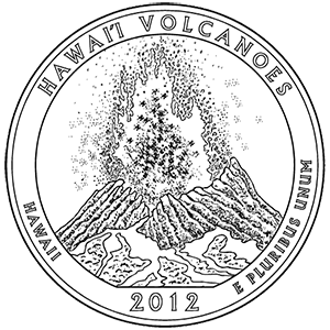
2012 · United States Mint image Official Mint coloring-page line drawing; reverse design by Charles L. Vickers. Design and artist source ↗
United States Mint quarter design · United States Mint. Open source ↗
- Quarter issue year
- 2012
- Retrieved
- 2026-10-30
- Image rights
- Image rights and source ↗
- Evidence
- Single source; not independently corroborated.
- Reuse
- Reverse designed by a Mint staff artist. Coloring-page graphic rights and any underlying third-party rights are not separately established. Do not imply Mint endorsement.
- Rights
- Reverse designed by a Mint staff artist. Coloring-page graphic rights and any underlying third-party rights are not separately established. Do not imply Mint endorsement.
Kamoamoa Fissure Eruption · NPS Photo. Open source ↗
- Information date
- Not supplied by the source
- Retrieved
- 2026-10-30
- Catalog image date
- 03/06/2011
- Source scope
- Hawaiʻi Volcanoes National Park
- Evidence
- Single source; not independently corroborated.
- Reuse
- Public domain:Full Granting Rights
- Rights
- Public domain:Full Granting Rights
Designation · National Park System directory. Open source ↗
- Information date
- Not supplied by the source
- Retrieved
- 2026-10-30
- Evidence
- Single source; not independently corroborated.
- Reuse
- Factual reference data; source attribution retained.
State or territory · National Park System directory. Open source ↗
- Information date
- Not supplied by the source
- Retrieved
- 2026-10-30
- Evidence
- Single source; not independently corroborated.
- Reuse
- Factual reference data; source attribution retained.
Park Map - Hawaii Volcanoes National Park · National Park Service, Harpers Ferry Center. Open source ↗
- Information date
- Not supplied by the source
- Retrieved
- 2026-10-30
- Source scope
- Hawaii Volcanoes National Park
- Download
- Official map PDF ↗
- Evidence
- Single source; not independently corroborated.
- Reuse
- Public domain; NPS map
- Rights
- Public domain; NPS map
People · People — National Park Service. Open source ↗
- Information date
- Not supplied by the source
- Retrieved
- 2026-10-30
- Source page last updated
- July 7, 2025
- Evidence
- Single source; not independently corroborated.
- Reuse
- NPS-authored U.S. government material is generally public domain; third-party content may have separate rights.
Places · Places — National Park Service. Open source ↗
- Information date
- Not supplied by the source
- Retrieved
- 2026-10-30
- Source page last updated
- October 8, 2024
- Evidence
- Single source; not independently corroborated.
- Reuse
- NPS-authored U.S. government material is generally public domain; third-party content may have separate rights.
Moʻolelo (Stories) · Moʻolelo (Stories) — National Park Service. Open source ↗
- Information date
- Not supplied by the source
- Retrieved
- 2026-10-30
- Source page last updated
- December 8, 2023
- Evidence
- Single source; not independently corroborated.
- Reuse
- NPS-authored U.S. government material is generally public domain; third-party content may have separate rights.
Collections · Collections — National Park Service. Open source ↗
- Information date
- Not supplied by the source
- Retrieved
- 2026-10-30
- Source page last updated
- April 27, 2021
- Evidence
- Single source; not independently corroborated.
- Reuse
- NPS-authored U.S. government material is generally public domain; third-party content may have separate rights.
Special Centennial Publications · Special Centennial Publications — National Park Service. Open source ↗
- Information date
- Not supplied by the source
- Retrieved
- 2026-10-30
- Source page last updated
- April 20, 2020
- Evidence
- Single source; not independently corroborated.
- Reuse
- NPS-authored U.S. government material is generally public domain; third-party content may have separate rights.
Cultural Resource Preservation · Cultural Resource Preservation — National Park Service. Open source ↗
- Information date
- Not supplied by the source
- Retrieved
- 2026-10-30
- Source page last updated
- March 24, 2023
- Evidence
- Single source; not independently corroborated.
- Reuse
- NPS-authored U.S. government material is generally public domain; third-party content may have separate rights.
The First Hawaiians · The First Hawaiians — National Park Service. Open source ↗
- Information date
- Not supplied by the source
- Retrieved
- 2026-10-30
- Source page last updated
- February 18, 2021
- Evidence
- Single source; not independently corroborated.
- Reuse
- NPS-authored U.S. government material is generally public domain; third-party content may have separate rights.
Buffalo Soldiers · Buffalo Soldiers — National Park Service. Open source ↗
- Information date
- Not supplied by the source
- Retrieved
- 2026-10-30
- Source page last updated
- February 6, 2024
- Evidence
- Single source; not independently corroborated.
- Reuse
- NPS-authored U.S. government material is generally public domain; third-party content may have separate rights.
Aliʻi · Aliʻi — National Park Service. Open source ↗
- Information date
- Not supplied by the source
- Retrieved
- 2026-10-30
- Source page last updated
- August 21, 2025
- Evidence
- Single source; not independently corroborated.
- Reuse
- NPS-authored U.S. government material is generally public domain; third-party content may have separate rights.
Japanese Detention at Hawaiʻi Volcanoes · Japanese Detention at Hawaiʻi Volcanoes — National Park Service. Open source ↗
- Information date
- Not supplied by the source
- Retrieved
- 2026-10-30
- Source page last updated
- June 23, 2022
- Evidence
- Single source; not independently corroborated.
- Reuse
- NPS-authored U.S. government material is generally public domain; third-party content may have separate rights.
Prince Jonah Kūhiō Kalanianaʻole · Prince Jonah Kūhiō Kalanianaʻole — National Park Service. Open source ↗
- Information date
- Not supplied by the source
- Retrieved
- 2026-10-30
- Source page last updated
- March 7, 2023
- Evidence
- Single source; not independently corroborated.
- Reuse
- NPS-authored U.S. government material is generally public domain; third-party content may have separate rights.
Mark Twain at Kīlauea · Mark Twain at Kīlauea — National Park Service. Open source ↗
- Information date
- Not supplied by the source
- Retrieved
- 2026-10-30
- Source page last updated
- December 1, 2021
- Evidence
- Single source; not independently corroborated.
- Reuse
- NPS-authored U.S. government material is generally public domain; third-party content may have separate rights.
Lieutenant Charles Wilkes · Lieutenant Charles Wilkes — National Park Service. Open source ↗
- Information date
- Not supplied by the source
- Retrieved
- 2026-10-30
- Source page last updated
- April 14, 2026
- Evidence
- Single source; not independently corroborated.
- Reuse
- NPS-authored U.S. government material is generally public domain; third-party content may have separate rights.
George W. C. Jones · George W. C. Jones — National Park Service. Open source ↗
- Information date
- Not supplied by the source
- Retrieved
- 2026-10-30
- Source page last updated
- July 28, 2025
- Evidence
- Single source; not independently corroborated.
- Reuse
- NPS-authored U.S. government material is generally public domain; third-party content may have separate rights.
Kenichi Maehara and the Volcano Photo Studio · Kenichi Maehara and the Volcano Photo Studio — National Park Service. Open source ↗
- Information date
- Not supplied by the source
- Retrieved
- 2026-10-30
- Source page last updated
- May 30, 2023
- Evidence
- Single source; not independently corroborated.
- Reuse
- NPS-authored U.S. government material is generally public domain; third-party content may have separate rights.
Pahu Manamana o ʻUmi · Pahu Manamana o ʻUmi — National Park Service. Open source ↗
- Information date
- Not supplied by the source
- Retrieved
- 2026-10-30
- Source page last updated
- February 28, 2024
- Evidence
- Single source; not independently corroborated.
- Reuse
- NPS-authored U.S. government material is generally public domain; third-party content may have separate rights.
The Great Crack and Ala Waiʻi · The Great Crack and Ala Waiʻi — National Park Service. Open source ↗
- Information date
- Not supplied by the source
- Retrieved
- 2026-10-30
- Source page last updated
- September 21, 2023
- Evidence
- Single source; not independently corroborated.
- Reuse
- NPS-authored U.S. government material is generally public domain; third-party content may have separate rights.
Kahuku-Pōhue · Kahuku-Pōhue — National Park Service. Open source ↗
- Information date
- Not supplied by the source
- Retrieved
- 2026-10-30
- Source page last updated
- June 2, 2026
- Evidence
- Single source; not independently corroborated.
- Reuse
- NPS-authored U.S. government material is generally public domain; third-party content may have separate rights.
Kaʻauea · Kaʻauea — National Park Service. Open source ↗
- Information date
- Not supplied by the source
- Retrieved
- 2026-10-30
- Source page last updated
- February 18, 2021
- Evidence
- Single source; not independently corroborated.
- Reuse
- NPS-authored U.S. government material is generally public domain; third-party content may have separate rights.
Pu‘uloa Petroglyphs · Pu‘uloa Petroglyphs — National Park Service. Open source ↗
- Information date
- Not supplied by the source
- Retrieved
- 2026-10-30
- Source page last updated
- April 18, 2025
- Evidence
- Single source; not independently corroborated.
- Reuse
- NPS-authored U.S. government material is generally public domain; third-party content may have separate rights.
Keonehelelei - The Story of the Footprints Area · Keonehelelei - The Story of the Footprints Area — National Park Service. Open source ↗
- Information date
- Not supplied by the source
- Retrieved
- 2026-10-30
- Source page last updated
- February 18, 2021
- Evidence
- Single source; not independently corroborated.
- Reuse
- NPS-authored U.S. government material is generally public domain; third-party content may have separate rights.
Uēkahuna · Uēkahuna — National Park Service. Open source ↗
- Information date
- Not supplied by the source
- Retrieved
- 2026-10-30
- Source page last updated
- February 1, 2024
- Evidence
- Single source; not independently corroborated.
- Reuse
- NPS-authored U.S. government material is generally public domain; third-party content may have separate rights.
Kealakomowaena: Life on a Lava Landscape · Kealakomowaena: Life on a Lava Landscape — National Park Service. Open source ↗
- Information date
- Not supplied by the source
- Retrieved
- 2026-10-30
- Source page last updated
- February 18, 2021
- Evidence
- Single source; not independently corroborated.
- Reuse
- NPS-authored U.S. government material is generally public domain; third-party content may have separate rights.
History & Culture · National Park Service. Open source ↗
- Information date
- Not supplied by the source
- Retrieved
- 2026-10-30
- Evidence
- Single source; not independently corroborated.
- Reuse
- NPS-authored U.S. government material is generally public domain; third-party material may have separate rights. No images copied.
Ecology · Nature — National Park Service. Open source ↗
- Information date
- January 22, 2021
- Retrieved
- 2026-10-30
- Evidence
- Single source; not independently corroborated.
- Reuse
- NPS webpage text; U.S. government work generally public domain. Third-party material may have separate rights.
Birds · Birds — National Park Service. Open source ↗
- Information date
- December 6, 2023
- Retrieved
- 2026-10-30
- Evidence
- Single source; not independently corroborated.
- Reuse
- NPS webpage text; U.S. government work generally public domain. Third-party material may have separate rights.
Plants · Plants — National Park Service. Open source ↗
- Information date
- October 19, 2024
- Retrieved
- 2026-10-30
- Evidence
- Single source; not independently corroborated.
- Reuse
- NPS webpage text; U.S. government work generally public domain. Third-party material may have separate rights.
Animals · Animals — National Park Service. Open source ↗
- Information date
- November 22, 2020
- Retrieved
- 2026-10-30
- Evidence
- Single source; not independently corroborated.
- Reuse
- NPS webpage text; U.S. government work generally public domain. Third-party material may have separate rights.
Invasive Animals · National Park Service. Open source ↗
- Information date
- Not supplied by the source
- Retrieved
- 2026-10-30
- Evidence
- Single source; not independently corroborated.
- Reuse
- NPS-authored U.S. government material is generally public domain; third-party material may have separate rights. No images copied.
Nāmakanipaio · National Park Service park structured data. Open source ↗
- Information date
- Not supplied by the source
- Retrieved
- 2026-10-30
- Evidence
- Single source; not independently corroborated.
- Reuse
- NPS-supplied text; NPS-authored U.S. government work is generally public domain, subject to third-party rights.
Kulanaokuaiki · National Park Service park structured data. Open source ↗
- Information date
- Not supplied by the source
- Retrieved
- 2026-10-30
- Evidence
- Single source; not independently corroborated.
- Reuse
- NPS-supplied text; NPS-authored U.S. government work is generally public domain, subject to third-party rights.
Things To Do · National Park Service. Open source ↗
- Information date
- Not supplied by the source
- Retrieved
- 2026-10-30
- Evidence
- Single source; not independently corroborated.
- Reuse
- NPS-supplied text; NPS-authored U.S. government work is generally public domain, subject to third-party rights.
Physical Address · Official park structured information. Open source ↗
- Information date
- Not supplied by the source
- Retrieved
- 2026-10-30
- Evidence
- Single source; not independently corroborated.
- Reuse
- NPS-supplied text; NPS-authored government work generally public domain, subject to third-party rights.
Mailing Address · Official park structured information. Open source ↗
- Information date
- Not supplied by the source
- Retrieved
- 2026-10-30
- Evidence
- Single source; not independently corroborated.
- Reuse
- NPS-supplied text; NPS-authored government work generally public domain, subject to third-party rights.
Telephone · Official park structured information. Open source ↗
- Information date
- Not supplied by the source
- Retrieved
- 2026-10-30
- Evidence
- Single source; not independently corroborated.
- Reuse
- NPS-supplied text; NPS-authored government work generally public domain, subject to third-party rights.
Recreation visits · National Park Service Visitor Use Statistics. Open source ↗
- Information date
- 2025
- Retrieved
- 2026-10-30
- Methodology
- NPS reporting unit; annual total is the sum of 12 monthly recreation visit estimates.
- Reporting unit
- Hawaii Volcanoes NP
- Evidence
- Single source; not independently corroborated.
- Reuse
- Factual reference data; source attribution retained.
